
In English
23 de setembro de 2020
Interactive Map Shows Your Location Millions of Years Ago – Level 3
Article published in Joca 157
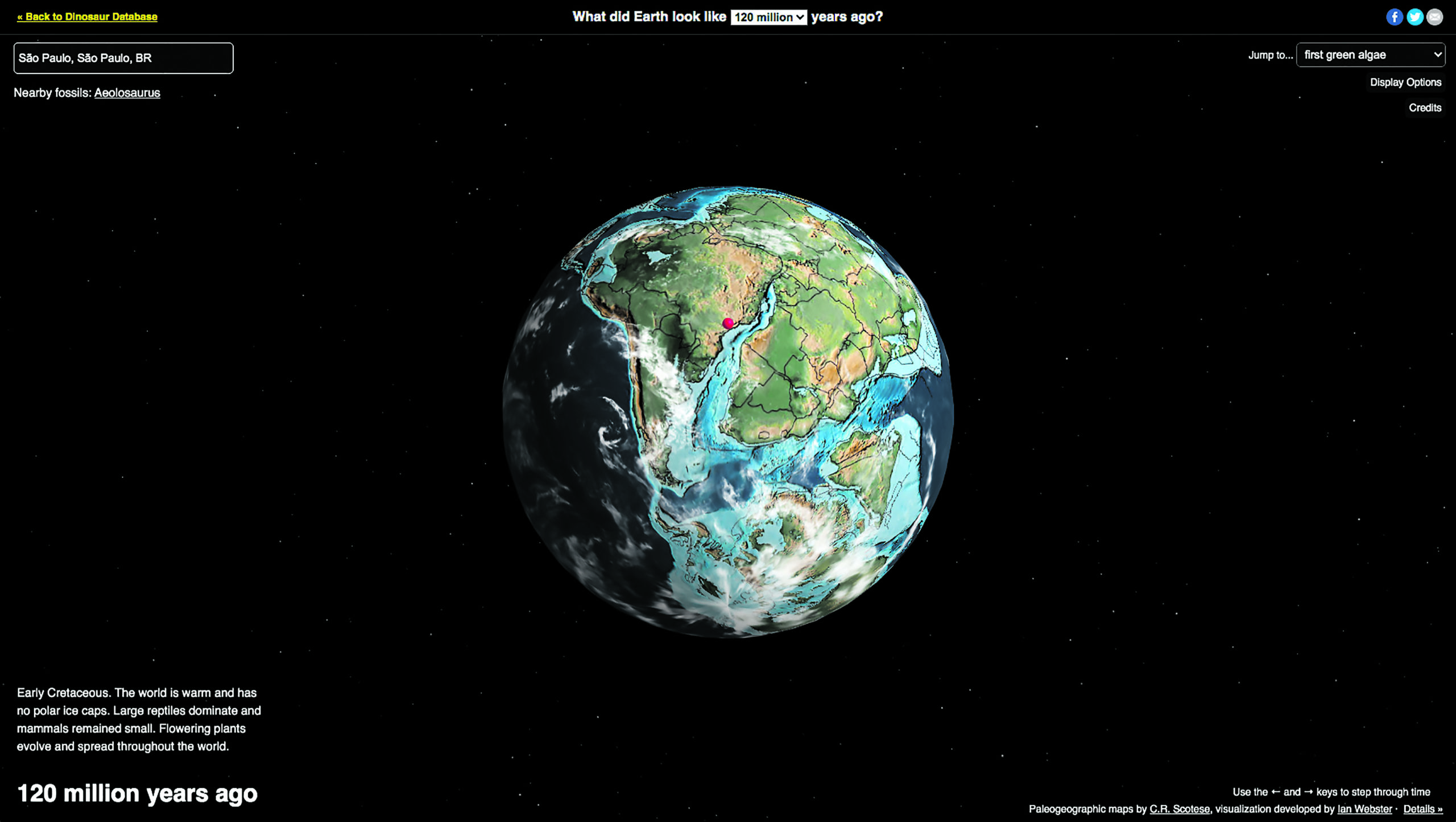


Earth was not always as we know it to be today. Over the years, climate conditions have changed and even continents have moved. With this idea in mind, Ian Webster, a palaeontologist (person who studies life on Earth as it was in the past) from California, in the United States, created a digital map where you can see how far a certain point on Earth has moved during its 750 million years.
You just have to go to the website and type in the name of the city where you live, for example. A 3D version of Earth will move and show you exactly where your location would have been in other times. It is possible to view the map during the period when the first vertebrate animals (that is, that have bones) appeared or when dinosaurs lived, for example.
“My software ‘geocodes’ the user’s location (that is, it understands where the user is) and then uses models [created by another professional] to run their location backwards in time,” Webster told CNN. “I built the global interactive globe visualization myself,” he added.
The site is in English and is available for free: bit.ly/mapa-antigo-terra
Pangea
Much of what you see on the interactive map of the past shows Earth during Pangaea. All the continents were joined together 200 million years ago – that is called Pangaea. Over time, ground movements led to continents’ separation.
Sources: CNN, Dinosaurpictures.org, and IG.
Questions
1) What can you do on the interactive map?
a) See real photos of the planet in the past.
b) Use a compass.
c) See what your location would be in the past.
d) Get to know animals from other periods.
2) Would you want to live on Earth in another time period? Why?
Ixi! Você bateu no paywall!
Ainda não é assinante? Assine agora e tenha acesso ilimitado ao conteúdo do Joca.
Assinante? Faça Login
Voltar para a homeOu faça sua assinatura e tenha acesso a todo o conteúdo do Joca
Assine
Edições impressas


Enquete
Sobre qual assunto você gosta mais de ler no portal do Joca?


Você precisa fazer o login para publicar um comentário.